


Yesterday was 109. Today is supposed to be…109. It was 105 degrees several days last week. Possibly all week, but my melted brain lost the ability to compute numbers by about Wednesday. It hasn’t rained it 40 days - which feels like a long time, but we’re actually not even halfway to the record of 84 days set in the year 2000.

As a fan of The Farmers’ Almanac, I like to keep track of all the government data sets and tools that track these kinds of things.
I have created a large map that has all of these datasets on one map here (no phone):
https://geopen.io/maps/texas-fire-watch.html
Drought
Things are exceptionally dry in the panhandle, but just abnormally dry everywhere else. Don’t flick your cigarette into a hay bail for at least a month please.
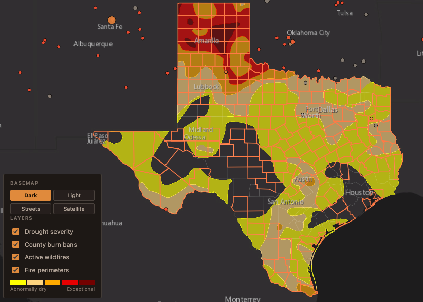
This data is from the U.S. Drought Monitor (https://droughtmonitor.unl.edu/) - a joint product of the National Drought Mitigation Center at the University of Nebraska–Lincoln, the USDA, and NOAA.
Burn Bans
We’ve currently got 177 out of 254 Texas Counties on a burn ban…67 of these have been created in just the past 2 weeks. If you need to destroy the painful memories of your ex-gf/bf, you can’t do it by slowly dropping photos into a burning fire.
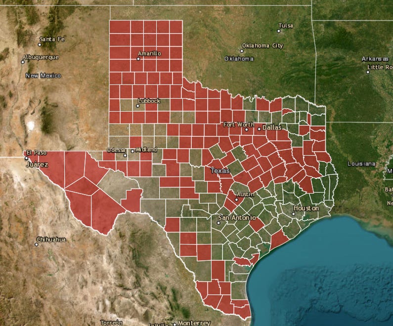
This data is also from Texas A&M Forest Service — the bans themselves are issued by county commissioners courts, not by the Forest Service; TFS aggregates and publishes them. So a county is the authority and TFS is the record.
Texas A&M Forest Service supplies counties with the Keetch–Byram Drought Index — a 0–800 scale of how dry the soil and vegetation are. Counties typically adopt a threshold (often KBDI ~575) as the trigger.
https://tfsweb.tamu.edu/burn-bans/
Wildfire Perimeters
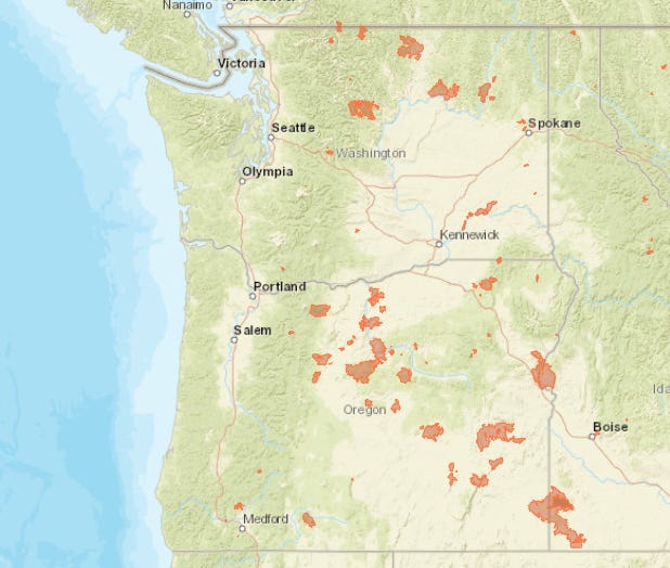
Things are not going well in eastern Oregon and Washington at the moment (not that all fires are bad or even unintentional). 3 million acres are burning in those 2 states across 153 fires with 14,391 people assigned to them. Most (50 of the 66 large fires) are over 80% contained.
The two fires that are currently the most out of control are both in Washington.
Little Giant - 142,218 Acres - 15% contained (2,338 crew)
Sinlahekin - 154,480 Acres - 47% contained (1,571 crew)
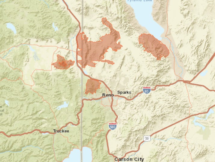
And now 90,000 people are being asked to evacuate the Hawk Fire, which is about 15,000 acres and 0% contained:
Here’s a fuller look at Western United States in terms of size and location.
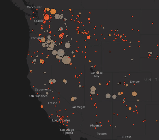
This data is from the National Interagency Fire Center (https://www.nifc.gov/) — incident locations and mapped perimeters, both through their open data portal (https://data-nifc.opendata.arcgis.com/), published as WFIGS (Wildland Fire Interagency Geospatial Services).
Wildfire Risk Explorer
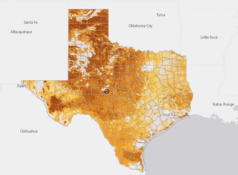
The Texas A&M Forest Service creates this dataset - Texas Wildfire Risk Explorer (WRAP). Below are the current conditions.
https://wrap.texaswildfirerisk.com/Map/Public/#whats-your-risk
Texas Wildfires
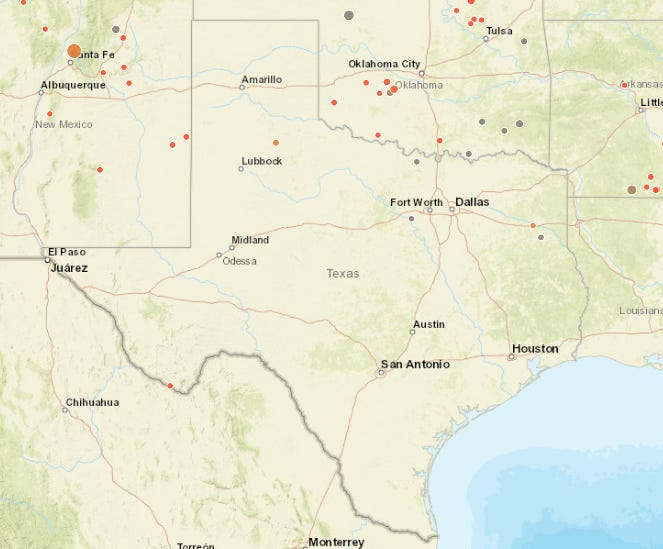
Texas is NOT burning. We’ve had some horrible Augusts (2011 and 2023), but the national fire feed only shows 6 current fires in Texas 216 acres.
This is interesting because this August has the conditions for it, but we haven’t had anything catastrophic yet - still a week left.
Stay cool everyone.
As always, feel free to email me at robert@themap.io