


How does the US Government categorize land?
https://themap.io/tools/land-cover
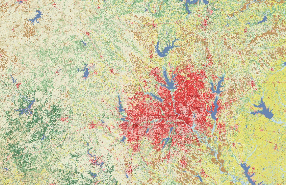
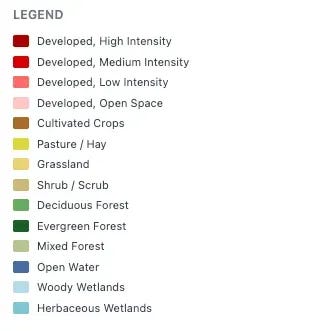
Since 1992, the USGS has kept of record of US land divided into 30x30 meters and given it a unique land type…you can see all of those in the legend above. It is produced by the Multi-Resolution Land Characteristics Consortium, a group of federal agencies who split the work. It’s published for survey years only, roughly every two or three years, which is why the available maps run 2001, 2004, 2006, 2008, 2011, 2013, 2016, 2019, 2021.
I hasn’t been updated since 2021 which is interesting.
email me a robert@themap.io if you want more information.
USGS NLCD (https://www.usgs.gov/centers/eros/science/national-land-cover-database) and MRLC (https://www.mrlc.gov/),